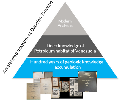
Value generation from deep knowledge of the Geology and Petroleum Industry of Venezuela and the Greater Caribbean
Extending existing knowledge in a geologically and statistically valid way beyond current producing properties
A guided four-step process for value creation in existing assets in Venezuela.
- Understanding of the facilities conditions and status for efficient asset management.
- AI ready curated information system.
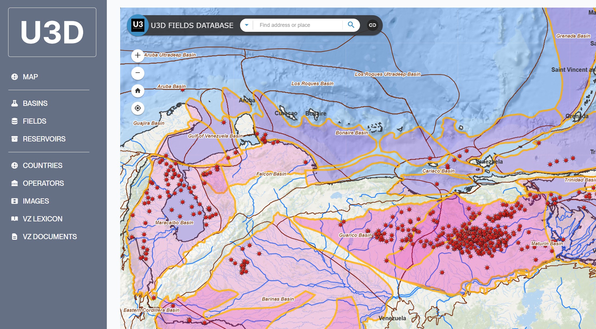
- Geologically defined edges of producing fields for Geospatial Analytics.
- Understanding of the controls on petroleum system(s): undeveloped discoveries and play trends.
- Technology and play-based exploration:
- Reprocessing of 1990’s 3D seismic data.
- New data acquisition.
- Accelerated interpretation with access to expert knowledge.
- Application of Contextual Augmented Intelligence.
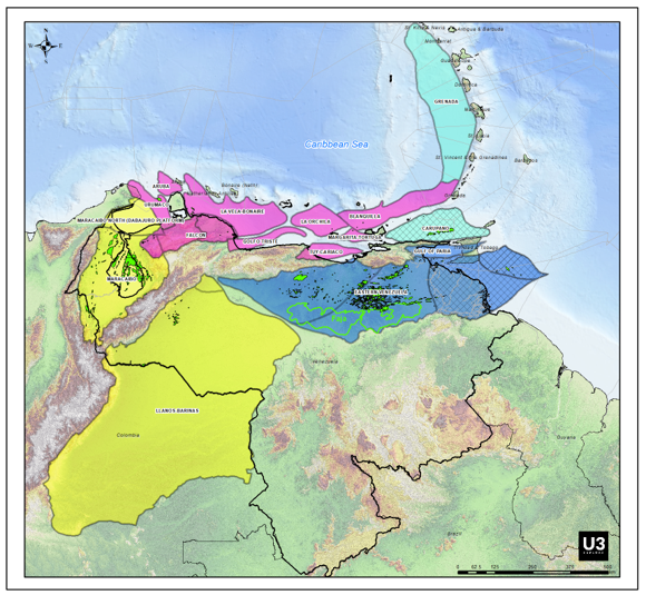
Play-based Exploration Atlas of Venezuela
Project rationale
- The Atlas of Venezuela integrates into a comprehensive view regional studies, recent drilling results, industry and academic studies and local expertise in Venezuelan, Colombian and Caribbean petroleum geology.
- U3 Explore regional experts have collected and reviewed legacy technical literature, and graduate studies and drilling results, and significantly revised and updated petroleum play concepts developed in the 1990s, not updated since the early 2000s.
Proprietary sources of information
- U3Dreservoir and field analogue database.
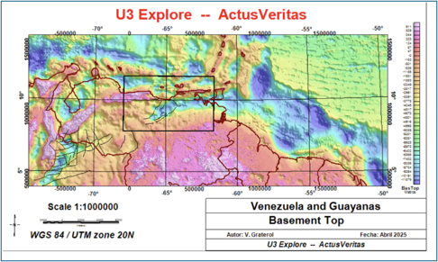
- Gravity inversions and depth to basement control points : aggregation of more 50-year data collection from Victor Graterol
- Collection of modeled gravity profiles.
- Depth to basement and depth to Moho maps from seismic, gravity and well data.
- Geochemical data points from GSI-Craig Shiefelbein.
- Global Tectonics deformable plate model.
- GIS database with U3 Explore basin classifications and play definitions.
Key Deliverables
GIS maps (regional or basin)
- Free Air, Bouguer and corrected Bouguer gravity.
- Depth to basement and depth to Moho maps.
- Paleo-crustal thickness, retro-deformed beta, tectonic subsidence and paleo-basement dip; paleogeography for key intervals.
- Source rock distribution and hydrocarbon characterization from analytic geochemistry.
- New basins classification for tectonically active margins.
- Play fairway maps and descriptions.
-
Reports (regional or basin)
- Companion report summarizing study results.
- Tectonostratigraphic framework with play elements.
Services
- Consultancy in asset potential assessment within a statistically meaningful framework.
- Access to a maintained U3D reservoir and oilfield analogue DB (subscription).
Sales contact:
Kenneth Mohn
E-mail: kwmohn123@gmail.com
