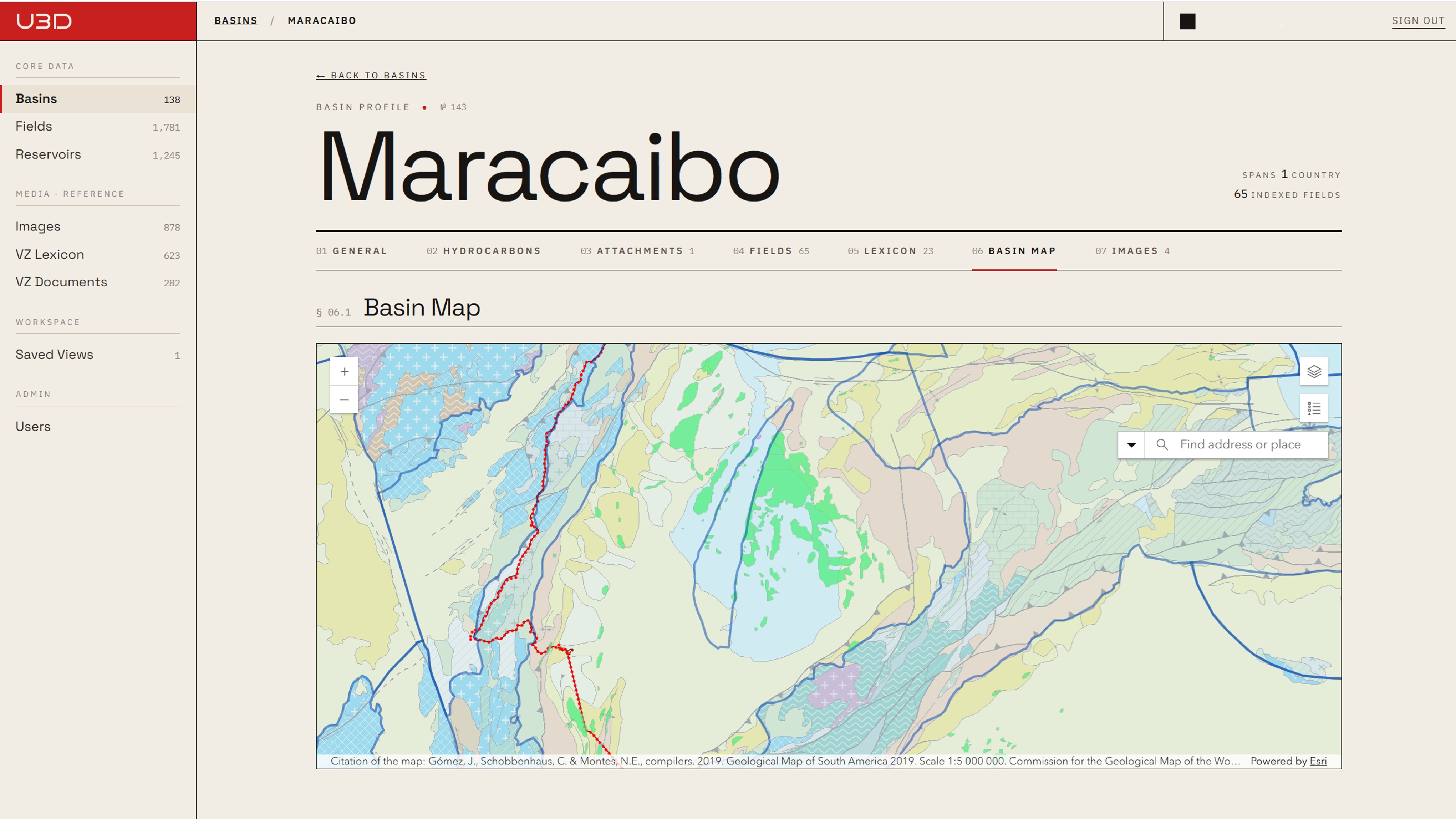
Every brownfield petroleum investment begins with a set of questions: Where are the best opportunities? What are the local and regional risks? How should they be mitigated? What are the uncertainties, and how should they be managed?
The obvious, and often most-easily available data brought to bear to answer these questions are production statistics and reserve volumes. In Venezuela, however, those numbers are merely the tip of the data iceberg (especially if the investment has exploration upside), and a great deal more context is needed for meaningful analysis. This can only come from a comprehensive geological understanding to establish statistically valid boundaries for assessing reservoir quality, production upside, optimal recovery options, and return on investment.
These Critical Challenges have been addressed by U3Explore, delivering a High-Performance Analytical System that has uncovered and organized Venezuela’s Institutional Knowledge into a model to support Investment Intelligence.
U3Explore Products & Background
After decades of exploration and production in some of the world’s most prolific petroleum provinces, Venezuela had generated one of the world’s largest collections of geological and reservoir studies. The problem arises, however, that this knowledge was dispersed through volumes of geological congress proceedings, published government statistics, and academic papers variously archived at universities and in personal libraries. As a result, it was not amenable to analysis using modern technology for asset comparisons and investment decisions.
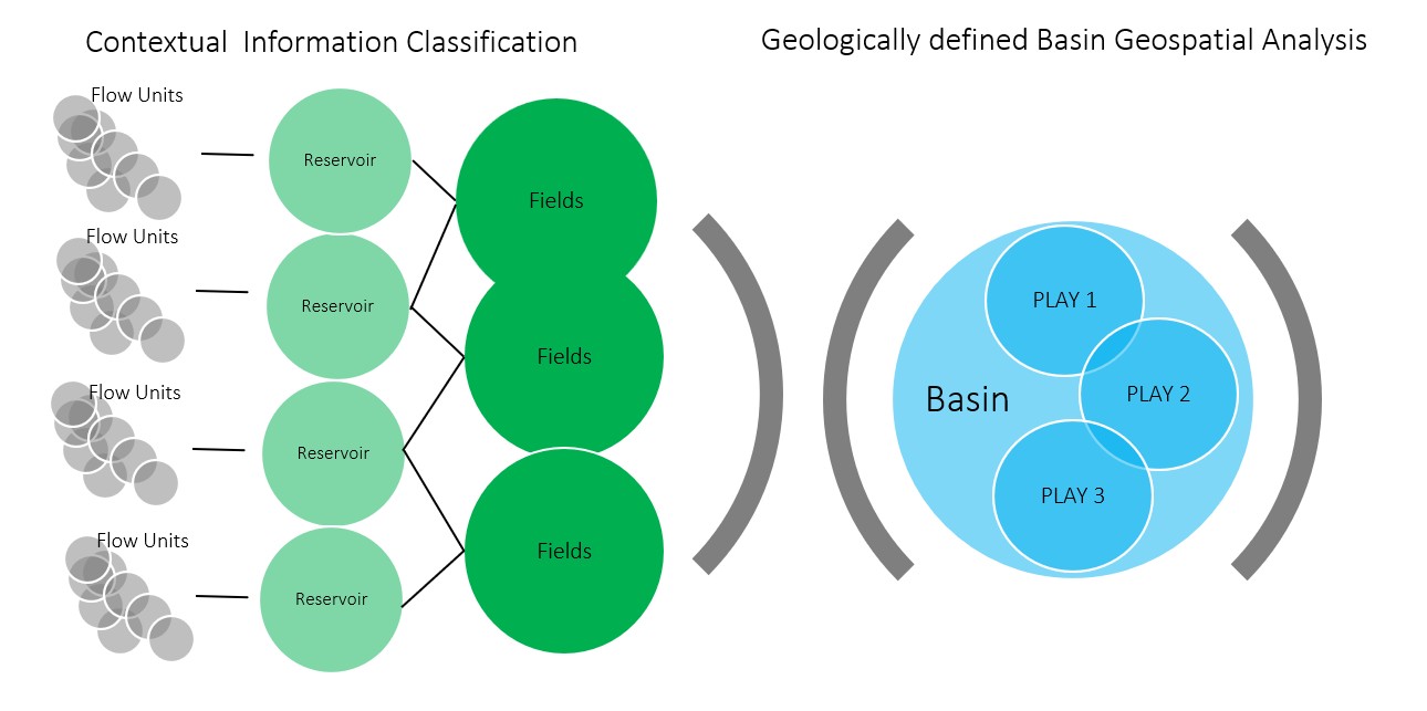
Furthermore, Venezuelan production data and reservoir properties were historically reported at the Flow Unit (individual sand pressure compartment) level within geographically-defined producing areas, using complex naming conventions that require country-specific experience to convert into geologically-contextualized intervals that could be input to analytical system. Those data are the basis of the U3D Flow Unit Database and are taken from the Reservoir Reserves Book, prepared by the Ministerio del Poder Popular de Petróleo (current as of December 31, 2019) and preserved in the Universidad Central de Venezuela Library archive. It contains 24,439 producing flow units, making it one of the largest publicly accessible compilations of Venezuelan reservoir engineering, reserves, and production information at the producing-interval level.
The U3D Flow Unit Database preserves production and reserve information at the producing-sand level and as such serves as the geological foundation for the Venezuelan portion of the Global U3D Field and Reservoir Analog Database which contains reservoir and field parameters organized at the Play Fairway and Reservoir Age (Formation) level.
The structure of the database enables U3’s integrated analysis of regional basin evolution and petroleum system to be applied to individual fields, reservoirs and flow units, establishing relationships between tectonics, stratigraphy, trap development, reservoir architecture, production performance, and reserves.
Within the U3D Global Analog Database, a reservoir is defined as a geological container such as a formation, member, or stratigraphic interval, which contains individual pressure-bound producing flow units. A flow unit is the smallest producing interval, typically an individual pay zone or sand body used historically for reservoir management, production allocation, and reserves reporting. Because reservoir quality, pressure behavior, production decline, recovery efficiency, and remaining recoverable volumes can vary significantly within a single reservoir, flow-unit data provides the resolution needed for more accurate reservoir characterization, analog selection, and production analysis.
In summary, U3D Venezuela Database organizes originally public but hard-to-obtain information into a relational geological framework, linking stratigraphic and spatial information recorded at different scales and turning historical knowledge into actionable investment intelligence by consolidating dispersed information into a structured, AI-ready platform that preserves the scale and resolution of the reported information organized by basins, fields, and reservoirs within a consistent geological framework to permit advanced asset screening. The methodology is described in more detail below.
The tool enables investors, operators, consultants, and government organizations to compare assets, benchmark reservoir performance, and identify redevelopment opportunities using standardized geological and engineering parameters.
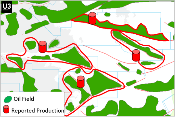
As noted above, Venezuelan production reported today by PDVSA reflects operational practices established decades ago, driven more by administrative or operational needs than by geological control over reservoir quality and trap development.
Reported volumes may therefore be linked to operational fields, production areas, gathering systems, contract areas, or surface facilities combining output from multiple wells and reservoirs. As a result, official production statistics cannot always be directly interpreted in terms of the geological field or reservoir performance.
U3 Explore addresses this problem by preserving the original reporting entity and developing a geological correlation framework that links reported production to interpreted basins, fields, reservoirs, and flow units. This work integrates basin analysis, structural geology, stratigraphy, reservoir correlations, GIS, and technical literature. The result is a transparent method that places production and reserves data within their appropriate geological context while maintaining traceability to the original official records.
Assigning all 24,439 flow units to their corresponding geological accumulations is ongoing. Historical field definitions, reservoir names, administrative boundaries, and production-reporting practices have changed over time, and many records require detailed technical review for reliable correlation. As new public information becomes available, the U3 Venezuela team refines geological relationships, production allocation, and reservoir classifications while retaining original source terminology and reporting history.
To support international benchmarking, the U3D Flow Unit Database preserves relevant Venezuelan terminology from the Definiciones y Normas de las Reservas de Hidrocarburos and aligns attributes with recognized international nomenclature, including SPE-PRMS. This dual-language engineering framework allows Venezuelan assets to be compared with global analogs without losing the concepts and classifications historically used by Venezuelan institutions.
The database preserves data on reservoir conditions, production, and reserves as reported through 2019, serving as a curated technical reference linking statistically-connected information Reservoirs of course continue to evolve as wells are drilled or shut in, pressures change, reserves are revised, production declines, and development strategies are updated, so the database is a living document.
U3D Flow Unit Database is well-suited for AI applications because of its structured, standardized architecture. Clients can integrate updated or proprietary geological, petrophysical, engineering, seismic, pressure, completion, and production data into the same framework. When combined with U3D Global, these datasets support advanced analog analysis, reservoir benchmarking, diagnostics, opportunity screening, resource evaluation, and AI-driven workflows for exploration, redevelopment, reserves management, mergers and acquisitions, and strategic investment decisions.
The foundation of the database is more than 17,000 physical legacy documents converted by U3Explore to digital format. This in-house research included the following publications:
- Bulletin, Venezuelan Association of Geology, Mining and Petroleum (AVGMP), published 1959-1983.
- GEOS Magazine - School of Geology and Mines, Universidad Central de Venezuela, published 1959-2015.
- Bulletin of the History of Geosciences of Venezuela, Sociedad Venezolana de Historia de las Geociencias, published 1984-2021.
- Bulletin of the Ministry of Mines and Hydrocarbons, Published 1951-1953.
- Bulletin of the Venezuelan Society of Geology, Published 1951-2011.
- Venezuelan Geological Congresses, Sociedad Venezolana de Geológos (SVG), published 1959-1997.
- Bolivarian Symposiums, Asociación Colombiana de Geólogos y Geofísicos de Petróleo, published 1982-2016.
However, the availability of public subsurface information varies significantly across Venezuela. In many mature producing areas, modern structural maps, reservoir boundaries, fault interpretations, well correlations, and detailed completion data remain unavailable in the public domain. Consequently, some geological field boundaries and production allocations entail a degree of uncertainty, and their interpretation must be approached with caution. These should be considered provisional and subject to revision as new data emerge. Researchers and practitioners are advised to critically assess these interpretations and remain open to refining geological models in response to improved data availability.
Summary
At U3Explore, we firmly believe that better geological understanding leads to better investment decisions. The hierarchy of products that deliver that understanding is:
- U3D Flow Unit Database → the premium, AI-ready module that powers the analog database and can be licensed separately or integrated for advanced analytics.
- U3D Venezuela → the flagship subscription product for field and reservoir analog benchmarking.
Thus the Flow Unit Database is both the foundation of the Venezuelan analog database and a stand-alone, high-value product for evaluating farm-ins, acquisitions, redevelopment projects, exploration portfolios, or national resource assessments. U3D provides the contextual geological framework needed to translate isolated data into informed technical and investment decisions.
Each petroleum asset represents a unique geological narrative. The primary challenge is converting this narrative into reliable investment intelligence.
U3D enables operators, investors, financial institutions, consultants, and government organizations to evaluate Venezuelan assets using globally recognized analog methodologies, supported by standardized geological, reservoir, and production analyses.
Organizations evaluating opportunities in Venezuela or seeking a more rigorous framework for reservoir benchmarking and asset screening are encouraged to experience U3D firsthand.
Contact U3 Explore to schedule a personalized demonstration and see how the Field and Reservoir Analog Platform translates geological information into business intelligence, reduces uncertainty, and supports better investment decisions.
References
Arminio, J. F., M. Sanchez, and D. S. Lewis, 2025. Propuesta de Clasificación Genética de Cuencas Sedimentarias del Norte de Suramérica y Sur del Caribe / Proposal for a Genetic Classification of Sedimentary Basins in North South America and the Southern Caribbean Domain: Extended abstract, XVIII Congreso Venezolano de Geofísica, Sociedad Venezolana de Ingenieros Geofísicos (SOVG), Caracas, Venezuela, November 12–15, 2025, 2 p.
Ministerio de Energía y Minas (MEM), 1997. Léxico Estratigráfico de Venezuela. 3rd ed., electronic edition (CD-ROM). Caracas, Venezuela. Digitized, standardized, and integrated into the U3D Venezuela Database by U3 Explore.
Ministerio del Poder Popular de Petróleo, 2019. Reservoir Reserves Book (Flow Unit Database), as of December 31, 2019. Public archive copy obtained through the Universidad Central de Venezuela Library, Caracas, Venezuela.
Society of Petroleum Engineers (SPE), American Association of Petroleum Geologists (AAPG), World Petroleum Council (WPC), Society of Petroleum Evaluation Engineers (SPEE), Society of Exploration Geophysicists (SEG), and Society of Petrophysicists and Well Log Analysts (SPWLA), 2018. Petroleum Resources Management System (PRMS). Revised June 2018.
VOSA (Venezuelan Oil Scout Association), 1990. Pozos Exploratorios de Venezuela, 1982–1989: Venezuelan exploration well scout report, 5,142 exploration wells, unpublished technical report, 112 p.
Contact: info@u3explore.com
